Image Colnect-1497-326-Map-of-the-Island.jpg
(333 x 204 pixels) |
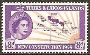
Type: stamp Issuer: Turks & Caicos Islands Date: 1959 Denom: ?
Visibility: public Image owner: none postage 7/4/1959 8d vio&yel issue=new constitution d=Queen Elizabeth II & map of the Turks & Caicos Islands wmk=mult crown & script CA perf=13.5x14 Crops No visible images cropped from this one. Measurements Resolution is unknown. Source Source name: Colnect File URL: http://i.colnect.net/b/1497/326/Map-of-the-Island.jpg Uploaded November 25, 2013, 7:06 pm by Stan Shebs |